Dear @swolny - many thanks again for the technical support and software troubleshooting advice.
I have taken your advice and followed up on the following:
- I have tried to use a different filled sinks version of the DEM
- I have also stopped using my work laptop which for some reason automatically sinks to a dropbox
- I have got a new license to install on my desktop computer which is not automatically saving to a dropbox
- I am now using ArcMAP rather than ArcGIS Pro - this is allowing me to save in .TIFF format
Shapefile with revised attribute table Uploading: 5_W2.zip…
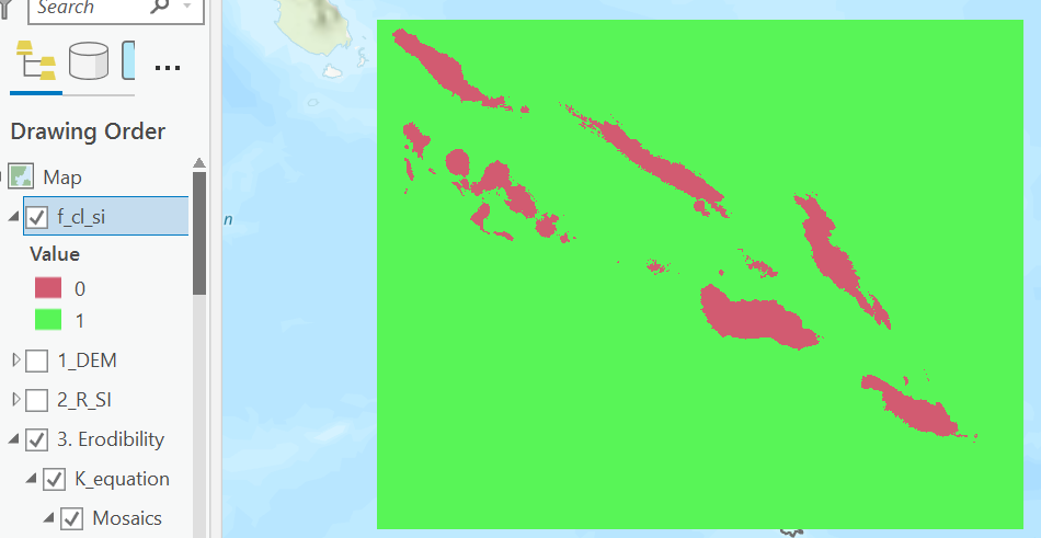
- Finally my LULC raster and my erodibility raster don’t fully cover the extent of the Southernmost island in this screenshot below. Can the model still run for the area that fits in the extent or will this stop the whole model from running?
The next day I tried to run the model again and this time it ran for some reason. According to the logfile attached there are no errors this time.
InVEST-Sediment-Delivery-Ratio-Model-(SDR)-log-2021-07-24–10_28_21.txt (1.1 MB)
However, the outputs don’t look quite right either see below:
Watersheds vector seems to be ok:

However the raster outputs do not seem right judging from the values ranges - sediment deposition is negative :

USLE results don’t provide much insight as shown here. Although the southernmost island is entirely blacked out.

A zoomed in version shows the USLE maybe showing deposition on the coastal ocean?

Sediment deposition just gives a high value for all ocean and a low value for all land
Processing: image.png…

All advice is appreciated on how to troubleshoot this is appreciated. Looking forward to discussing.
Thanks again